


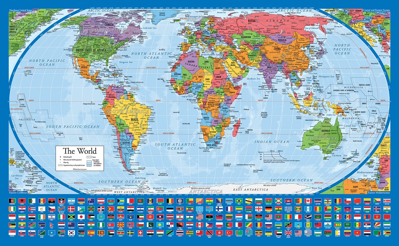

The world may soon have a new way of looking at itself. This is not plastic surgery but a true scale and representation correction.
The United Nations General Assembly has overwhelmingly backed a resolution led by Togo calling for a more accurate representation of the relative size of the world’s continents, in a move that could see the familiar Mercator map gradually give way to the Equal Earth projection.
The resolution, spearheaded by Togo on behalf of African countries and supported by the African Union, was adopted on Friday, September 4, with 164 countries voting in favour, 6 abstaining and only the United States voting against it.
Titled “Correct the Map,” the initiative seeks to address what African countries describe as a long-standing distortion in the way the world is visually represented.
At the centre of the debate is the Mercator projection, a map created by European cartographer Gerardus Mercator in 1569. Although the projection remains highly useful for navigation because it preserves directions and angles, it significantly distorts the apparent size of land masses as they move away from the equator.
This means that countries and regions in the northern and southern extremes of the globe appear considerably larger than they actually are, while areas around the equator appear smaller.
Africa is one of the biggest casualties of this distortion.
On the conventional Mercator map, Greenland appears comparable in size to Africa. In reality, however, Africa is about 14 times larger than Greenland.
The distortion is not limited to Africa. Latin America, South Asia and other regions close to the equator also appear smaller relative to countries in the northern hemisphere.
The African Union has argued that the problem goes beyond cartography and maps.
For decades, maps used in classrooms, textbooks, offices and digital platforms have helped shape how people understand the geographical importance and scale of different parts of the world. African proponents of the campaign therefore argue that repeatedly seeing the continent represented as smaller than it actually is, can contribute to a broader psychological and historical minimisation of Africa.
The new approach favours the Equal Earth projection, which was developed in 2018 specifically to preserve the relative areas of countries and continents while still producing a practical world map.
Under the Equal Earth projection, Africa takes on a dramatically larger visual presence, while Europe, North America and Greenland appear significantly smaller than they do on the Mercator map. Africa in reality can swallow United States, China, India, Japan, and all of Europe.
The change, however, does not mean that the Mercator projection will disappear overnight.
The UN resolution is non-binding and does not prohibit governments, businesses or individuals from continuing to use Mercator maps. Mercator also remains particularly useful for navigation, where its ability to preserve constant bearings is an important advantage.
Instead, the resolution encourages governments, educational institutions, international organisations and technology companies to consider equal-area projections when representing the world, particularly in contexts where the relative size of regions matters.
For Africa, the vote represents more than a technical discussion among cartographers.
It is being presented as part of a broader effort to challenge historical narratives and representations that have shaped how the continent is perceived globally.
The African Union has been at the centre of the campaign, with Togo taking the issue to the United Nations on behalf of the African group. The campaign argues that a more accurate map can help correct what it describes as the continent’s “symbolic minimization” in the global imagination.
The debate has also attracted support beyond Africa.
Several European countries backed the resolution, while France has indicated that it will move away from the traditional Mercator representation in favour of maps that more accurately portray the world’s land areas.
But the United States opposed the resolution.
Washington’s objection has added a political dimension to what might otherwise appear to be a technical debate over cartography. The US argued that the initiative represented more than a simple effort to update map proportions, framing it as part of a broader ideological project.
Supporters of the resolution, however, insist that the issue is precisely about perception.
The question, therefore, is not whether a map can be completely distortion-free, but which characteristics should be preserved and for what purpose.
For navigation, the Mercator projection remains highly useful.
For teaching people how large Africa, South America or other regions actually are, an equal-area projection may provide a fairer picture.
The significance of the UN vote could ultimately extend beyond classrooms and printed atlases.
Digital mapping platforms, technology companies, publishers and educational institutions will now face greater pressure to reconsider which projections they use when presenting the world to billions of people.
The debate also raises a much bigger question. Does the way we draw the world influence the way we understand it? As an African, I would answer affirmatively. Perceptions matter. A smaller representation of an otherwise bigger Africa justifies why others could loot Africa because after all, an Island like Greenland is represented as having same size of a whole continent
Africa is not becoming bigger because of the UN resolution. It has always been the same size.
What is changing is the picture people see. And for the first time, the world’s leading international organisation has formally backed an effort to ensure that picture comes closer to reality. The power of pictures cannot be oversimplified. Pictures and images speak more than words could ever do.