


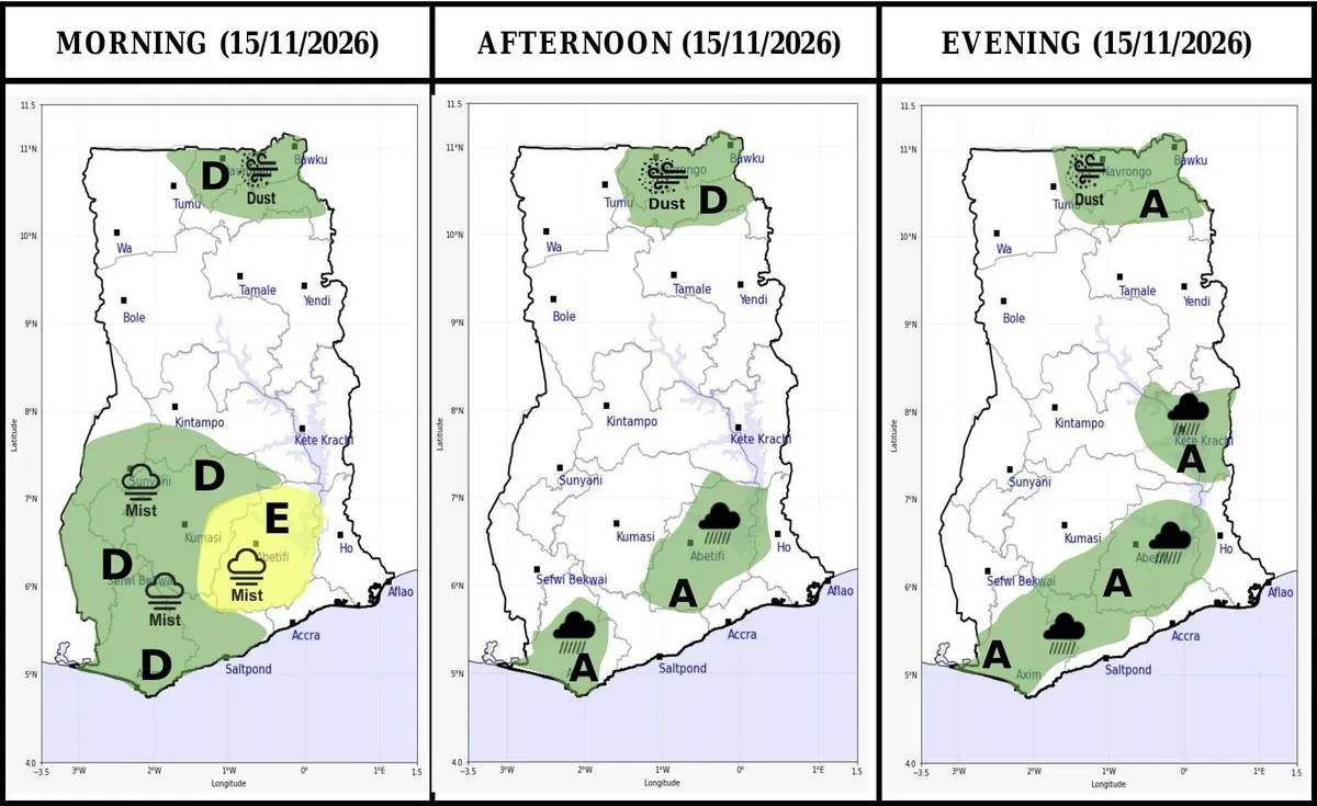

Localised thunderstorms or rain could break out in a few places across southern and central Ghana late on Sunday afternoon and into the evening, the Ghana Meteorological Agency says.
Its 18-hour impact-based forecast, issued at 5:00 am and valid from 6:00 am on Sunday, November 15, rates the risk as low, with less than a 40 per cent likelihood and low impact.
For the afternoon, GMet’s maps mark rain over parts of the Eastern Region around Abetifi on the Kwahu ridge, and over the south-west around Axim.
By evening the marked area widens into a belt from Axim north-east towards Kwahu, with a separate patch around Kete Krachi in the Oti Region.
The showers come as Ghana heads into a dry season GMet expects to be hotter and drier under a very strong El Niño.
Mist will cover parts of the coast, the forest belt and hilly areas early in the day, before most of the country turns sunny and warm with some cloud.
Slightly hazy conditions are also forecast over parts of the extreme northern sector, around Navrongo and Bawku.
Temperatures across the country
Coastal areas are forecast to reach 32°C, the forest zone 34°C, the transition belt 35°C and the northern sector 38°C, with lows between 22°C and 23°C.
Anyone travelling this afternoon or evening, or heading to an outdoor event, should plan for a possible downpour and slippery roads in those areas.
The agency and NADMO have urged churches and mosques to lead community preparedness, while MoFA is drafting a national El Niño plan to shield crop output.